Water Foundation (WF): Can you explain the relationship between floods and groundwater?
Aysha Massell (AM): California’s Central Valley was once known as an inland sea because of the vast amounts of flood water that inundated the valley floor virtually every spring. In major flood years, water would jump over river banks and spread out onto the landscape, in areas called floodplains. This flood water, along with rain and snow throughout the watershed, slowly percolated into the soils and over millennia the valley basin became filled with the groundwater that communities and farmers still depend on today.
However, only 5% of those original floodplains in the valley remain. In their place is a vast network of leveed rivers, canals, bypasses, and pumps.
Daniel Mountjoy (DM): As we have confined rivers to protect our cities, towns, and farmland, we also began pumping groundwater during droughts to meet the growing demand of people and crops. This has resulted in decades of groundwater depletion while we have reduced the spread of river water that used to naturally replenish aquifers.
AM: Over-pumping has caused groundwater levels to drop precipitously low, the valley floor to sink, and water quality issues to plague communities, while the specter of drought and flood always looms. To address this, I believe one fundamental action needed is to reconnect rivers to their floodplains. Floodplains are key to healthy riparian systems and provide so many benefits, including flood risk reduction, valuable ecosystem habitat, improved water quality, and groundwater recharge.

San Joaquin National Wildlife Refuge, Steve Martarano / US Fish and Wildlife Service
DM: With what California has already experienced in the way of a changing climate, and what experts are predicting will only intensify, California needs a lot of options for capturing as much floodwater as possible when it hits and save it for the dry years ahead. A process called groundwater recharge is one way of making the most of wet years like the one we had this year, and on-farm recharge is a specific way to boost water supplies for farmers, local communities, and the environment together.
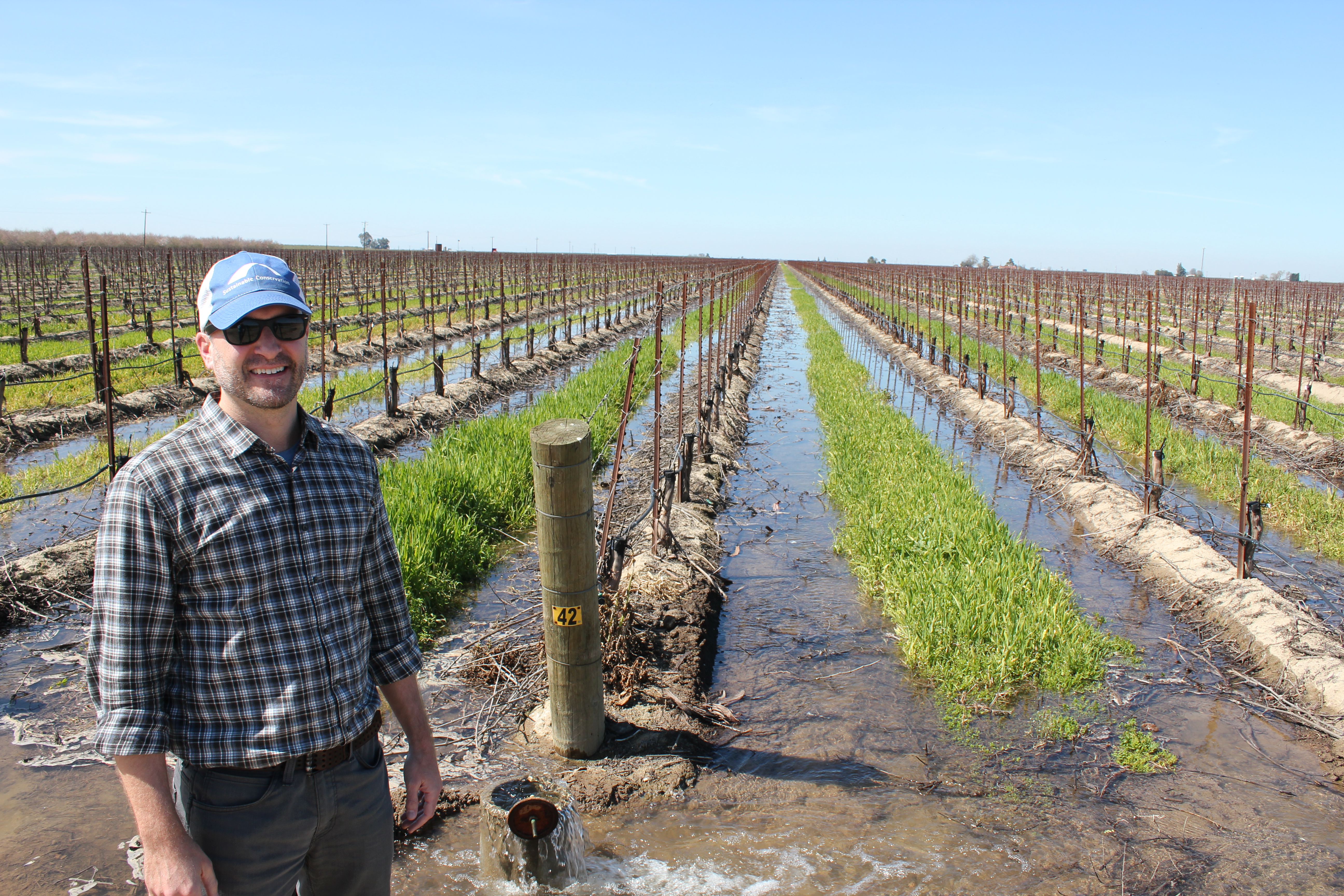
Here’s how it works: when it rains a lot and rivers get swollen, available floodwater that would otherwise flow to the ocean is funneled through existing irrigation canals and then spread on to farms that are actively growing crops, are between crop rotations, or have land that has been fallowed.
The water percolates through the soil and eventually fills up depleted groundwater reserves. It stays underground until it’s pumped out to irrigate crops like almonds, walnuts, and wine grapes and supply water for homes.
WF: Who’s doing a good job of capturing floodwater to grow California’s groundwater supplies?
DM: There’s a growing number of water districts and farmers in the San Joaquin Valley making promising strides in proving out on-farm recharge. My organization, Sustainable Conservation, is evaluating and actively promoting the practice throughout the valley, and is providing these early adopters with guidance and tools for maximizing their success.
The Madera Irrigation District, for example, provided tens of millions of gallons of free irrigation water to growers earlier this year, as well as in the wet winter of 2017, for on-farm recharge in its district. San Joaquin County grower Al Costa offered up his 20-year-old Zinfandel vineyard for recharge pilots three years in a row. Don Cameron of Terranova Ranch in Fresno County has led a large-scale project that’s been nearly a decade in the making. Once complete, the project could grow the local aquifer by up to 30,000 acre-free each month when floodwater from the Kings River is available.

Water floods one of Al Costa’s vineyards in Lodi, CA, Sustainable Conservation
These projects may sound like a drop in the bucket considering that the San Joaquin Valley’s average groundwater overdraft is nearly 2 million acre-feet a year, according to the Public Policy Institute of California. But, if they can be replicated and expanded across the valley, we could make a big difference in boosting California’s water resiliency.
AM: On the Cosumnes River Preserve near Sacramento, The Nature Conservancy and UC Davis have been leading one of the first projects in the Central Valley to document the connection between floodplain inundation and groundwater recharge. Even during the recent drought, one of the worst in California’s history, allowing the levee-free Cosumnes River to inundate the preserve’s 165 acres of natural floodplain recharged between an estimated 228 million and 1.7 billion gallons of water per year to the underlying aquifer.
My organization, American Rivers, and many others are working on a range of multi-benefit floodplain projects in the Central Valley. The Great Valley Grasslands Floodplain Restoration project, for example, involves removing parts of a levee on the San Joaquin River to allow the river to spread out during floods. Reconnecting the river to its 120 acres of floodplain will help nearby terrestrial and aquatic habitats that need both surface water and groundwater to stay healthy.
WF: So, what do we need for more projects like these to get going?
AM: We need more research to better understand Central Valley geology and to find the hidden pockets where aquifer recharge can work. For example, we know there are veins of highly permeable soils like gravel in the valley, but we don’t always know exactly where they are or where the water would end up after reaching these veins. Researchers are starting to apply 3D modelling and electromagnetic imaging techniques coupled with onsite physical data analysis to figure this out.
Equally important is understanding the water quality impacts of recharge. Recharge projects should be located and managed to improve water quality and quantity for communities, not to increase their pollution burdens.
DM: One way to move from unintentionally worsening water quality to intentionally improving water quality and groundwater supply is to concentrate recharge on fewer acres where more water can successively be applied whenever surface water is available. Repeated recharge in one place helps flush legacy chemicals and dilute contaminants in the aquifer.
AM: We also need to overcome permitting challenges in implementing natural infrastructure solutions. To reconnect rivers to their floodplains, we often must remove or set levees back from the river, but the permitting process can be difficult and costly to navigate. Agency review is necessary to ensure that projects are done correctly to protect communities and the environment, and to address our urgent water needs, we must overcome barriers and find a clear path to expedite our permitting processes.
DM: One key to increasing groundwater recharge in the valley – whether on farmland or in dedicated basins – is giving water managers essential tools and insights to maximize their opportunities.
That’s why we created an online tool, the Groundwater Recharge Assessment Tool or GRAT, with Earth Genome and the Tulare and Madera irrigation districts. The tool identifies optimum recharge sites based on factors like soil and crop type, and timing of water deliveries. In addition to these irrigation districts and other water districts, the California Department of Water Resources is also using GRAT to figure out the potential to capture and recharge the more extreme floods predicted for Merced River resulting from climate change.
To really scale groundwater recharge, incentives are needed – like low-cost water for recharge purposes and credit for the water farmers put into the ground. Many farmers have switched to drip irrigation that’s not compatible with flooding farmland for recharge. Those farmers need funding support to add recharge-appropriate irrigation systems and methods for getting available floodwater to the right locations.

Don Cameron of TerraNova Ranch stands in a flooded almond orchard, Paolo Vescia
WF: What else should people know?
DM: All on-farm groundwater recharge projects, no matter their size, are vital in building trust among producers that this is a viable and safe option for building the state’s groundwater reserves. Recharge is much cheaper than building new surface reservoirs, has few environmental hurdles, can be implemented within a relatively short time frame, and helps protect downstream communities from flooding.
AM: We need more integrative thinking that reaches across disciplines and policy objectives, and floodplains exemplify this approach. We can bring back species from the brink of extinction, improve water quality, invest in sustainable agricultural practices, and protect communities. In my opinion, restoring floodplains is a cornerstone of a sustainable water future that can help us achieve multiple societal objectives, especially as we adapt to a changing climate.